New technologies influence and change every aspect of our lives. When it comes to housing, we tend to think about smart-home devices. But augmented reality (AR) and virtual reality (VR) also have a role, as they are becoming the most advanced tools for urban planners, as it helps them work better and more efficiently.
How AR and VR are beneficial for urban planning
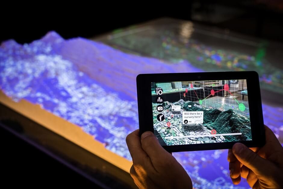
- Visualizing Big Data
Let’s focus on the example of residential area expansion. Urban planners and utility providers (hydro, sewage, water…) need to work together and determine whether the existing networks are capable of handling the extra load. However, hard data is not easy to decipher. With visual representations in VR or AR, stakeholders have a clear view of the upcoming changes and can decide whether they need to resize the utility networks to accommodate residential expansion.
- Understanding the Impact of New Buildings on Traffic
With every new business or commercial building added to a specific area, its traffic pattern will change, as the number of cars is increasing.
Ariel Noyman, a researcher at MIT Media Labs explains: “If we add an office building, that might be another 700 people leaving in cars and more congestion. We want people to be able to physically visualize congestion, and physical, tangible tools are better for understanding what happens in a city.”
- Rehabilitating Historic Buildings and Monuments
Rehabilitating historic buildings is a delicate task. Workers must preserve the original look and, as much as possible, use similar materials to the original ones.
Augmented reality overlays can help architects show urban planners the result of the rehabilitation works they propose.
- Encouraging Citizens to Participate in Urban Development Projects
Public utility projects usually need to go through a public consultation phase before the construction work actually start. Usually, the general public sees some design plans and a 2D computer rendering, but they are starting to be replaced by simulation videos and 3D photographs of future buildings and developments.
How London uses VR for its city planning
This is the strategy currently adopted by the city of London. Its VR program recently showed visitors a digital model of Victoria Park, which have been fodder for much debate in the city, surrounded by proposed highrise buildings. After debuting at this year’s Ribfest, it was then showcased at the St. Peter’s Basilica Cathedral’s Auditorium a few weeks ago.
“We were collecting feedback for the Victoria Park Secondary Plan,” says Urban Design Technician James Scott. “We are utilizing technology such as the VR that we have set up here to try to inform the public about potential development around the park.”
With the virtual reality headset on, people could toggle through the different proposals, as well as interact with it. Michelle Knieriem, who works as a planner with the City of London, says: “This really helps show how those policies we put in to help tall building development can work on the ground and what it actually looks like to a pedestrian. It’s impossible to visualize unless you’re on the ground. VR helps to better inform our perspective and the recommendations we’re making.”
With virtual reality, city planners can show how the proposed buildings would cast shadows, affect light levels and change the view of someone taking a stroll through Victoria Park or driving down Richmond Street.
Thanks to AR and VR, citizens can get a more realistic view of how these projects will fit into the environment and relate to the existing buildings. Being able to interact with 3D models can help people make an informed decision whether they agree with the proposed project or not.